The Bernese Oberland
Two lakes, three famous peaks, a valley of waterfalls and four car-free villages, all within half an hour of one junction town.
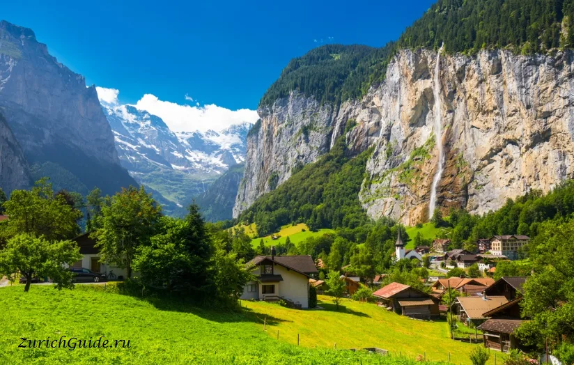
The Bernese Oberland is the mountain part of canton Bern, and it is the Switzerland of the imagination: the Eiger, Mönch and Jungfrau in a row, a valley with seventy-two waterfalls, car-free villages on shelves above it, and two lakes of improbable colour below.
It is also the most compact of the mountain regions. Everything below is within about forty minutes of Interlaken, which sits between the two lakes and is where every route changes.
Where to base
The question that matters, since the region is small enough that base choice is about atmosphere rather than access.
Interlaken — the junction. Not worth seeing in itself; everything connects here, and it has the hotels and the shops. Use Interlaken Ost, not West.
Lauterbrunnen — the valley floor between vertical walls, with the waterfalls. Quiet, dramatic, and the gateway to the shelves above.
Grindelwald — sunniest and largest, directly under the Eiger north face, best connected since the Eiger Express opened in 2020, most crowded.
Wengen — car-free shelf, sunny, on the railway to the Jungfraujoch.
Mürren — car-free shelf opposite, smaller and quieter, with the three peaks lined up straight ahead.
Thun or Spiez — on the lake, cheaper, and half an hour out.
The set pieces
Jungfraujoch — the highest railway station in Europe at 3,454 m, with the Aletsch glacier below. Expensive, weather-dependent, and extraordinary on a clear day.
Schilthorn — the revolving restaurant above Mürren, and the Bond connection.
Harder Kulm — eight minutes by funicular above Interlaken, both lakes below, and the cheapest good view in the region.
Schynige Platte and Männlichen — the two viewpoints that give you the same three peaks for a fraction of the Jungfraujoch price. See which mountain to go up.
The lakes
Thun — broad, with castles along it at Thun, Spiez and Oberhofen.
Brienz — smaller, steeper, and an improbable turquoise, with the Giessbach falls and the last steam rack railway in Switzerland.
Both have scheduled boats from Interlaken Ost, covered by rail passes; see the lakes.
The valleys behind
Kandersteg and the Oeschinensee — the best short walk in Switzerland.
Meiringen — the Reichenbach falls, the Aare gorge, and Sherlock Holmes.
Brienz — woodcarving, the steam railway and Ballenberg.
Gstaad — the Saanenland, at the western end and a world of its own.
Getting there
- By train — Zurich to Interlaken Ost about two hours; Bern under an hour; Lucerne about two hours on the scenic Brünig line.
- The GoldenPass runs Lucerne–Interlaken–Montreux through the middle of it.
- Regional passes — the Jungfrau and Berner Oberland passes cover the lifts properly, where a national pass only discounts them. See tickets and passes.
When to go
June to September for walking, when the high paths are clear and everything runs. December to April for skiing across Grindelwald, Wengen and Mürren.
April and November are the closed months, when a good share of the mountain transport shuts for maintenance. See when to go.
Weather in The Bernese Oberland month by month
| Month | Day | Night | Rainfall |
|---|---|---|---|
| January | +3° | -3° | 72 mm |
| February | +6° | -2° | 67 mm |
| March | +11° | +1° | 73 mm |
| April | +15° | +4° | 82 mm |
| May | +19° | +8° | 122 mm |
| June | +23° | +12° | 127 mm |
| July | +24° | +14° | 146 mm |
| August | +24° | +14° | 146 mm |
| September | +19° | +10° | 94 mm |
| October | +14° | +6° | 80 mm |
| November | +8° | +1° | 80 mm |
| December | +4° | -2° | 91 mm |
Normals for 1991–2020 from MeteoSwiss, station Interlaken, open data, version of 29 July 2026. Day and night are the average daily high and low, not records; rainfall is approximate. Current conditions from the Norwegian Meteorological Institute, CC BY 4.0.
Updated: