Engelberg and Titlis
A Benedictine abbey in a high valley, and the rotating cable car to a glacier at 3,020 metres above it.
Engelberg sits at 1,000 m in a closed valley south of Lucerne, and it has two quite separate reasons to exist: a Benedictine abbey founded in 1120, and a glacier at the top of the valley reached by cable car.
The name means mountain of angels, from the legend that angels were heard singing on the ridge above where the monastery was to be built.
For most visitors it is the easiest glacier in Switzerland to reach — under two hours from Zurich, and the whole thing works as a day trip.
Finding your way
Engelberg sits on the border between the cantons of Obwalden and Nidwalden; climb into the hills behind it and you’re already in Nidwalden, and cross the Jochpass beyond that and you’re in Bern. The main street is Dorfstrasse, where most of the shops and restaurants are; several close for a few weeks in November, between the summer and winter seasons.
The monastery is a short walk east of the station along Dorfstrasse and then Klosterstrasse, passing the tourist office on the way. The lift up to Ristis and Brunni starts just beyond it. The lift to Gerschnialp — for Trübsee, Stand and the Titlis cable car — is the other way, a walk south-west of the station, and the Fürenalp cable car is a few kilometres further east again, along Oberbergstrasse.
Titlis
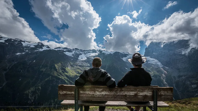
Mount Titlis is 3,238 m; the station on it is at 3,020 m, and it is the highest point in central Switzerland you can reach without walking.
The final section is the Rotair — a cable car whose cabin rotates through 360° during the ascent, so everyone gets the whole view without moving. It was the first of its kind in the world when it opened in 1992, and it remains a good trick.
At the top:
- The glacier cave — a tunnel cut 150 m into the ice, lit blue, several degrees below zero
- The Titlis Cliff Walk — a suspension bridge along the rock face at around 3,000 m, the highest in Europe, with a 500 m drop under it
- The glacier park in summer, where you can sledge and tube on snow in July
- Restaurants, and a great many people
The ascent runs in stages, each with its own onward lift: Gerschnialp (around 1,300 m), Trübsee (1,800 m), Stand (2,428 m), and finally the Rotair up to the glacier station. A chairlift below the summit station drops down to the ice park for those who’d rather tube than sightsee, with free rubber-ring runs down a short slope.
Dress for winter whatever the month, bring sunglasses, and go early: the mountain clouds over by afternoon far more often than not.
Trübsee
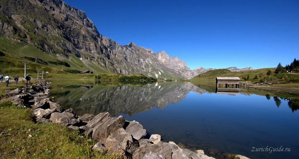
Halfway up, at 1,800 m, is Trübsee — a lake that reflects the surrounding peaks on a still morning and is the reason to break the journey rather than riding straight through.
A flat path circles it in about an hour, there are rowing boats in summer, and it is the start of several good walks. If the summit is in cloud, this is where to stop instead: the view is most of what you came for and the ticket is a fraction of the price.
The name means roughly murky lake, from the fine glacial silt suspended in the water — it clears as the season goes on. It’s also the start of the path up to the Jochpass (below), and of a longer route past Engstlensee and two further lakes to Melchsee-Frutt, most of a day’s walk if you go all the way.
Brunni and Fürenalp
The other side of the valley above Ristis is Brunni — smaller and quieter than Titlis, reached by the same lift as Ristis and continuing up to 1,860 m, with a further chairlift to Schönegg at 2,040 m. It has its own network of graded walking paths, a paragliding launch at the top, and a children’s Yeti Park near the Ristis station.
Fürenalp, a cable car a few kilometres east along Oberbergstrasse, tops out at 1,840 m and is quieter again.
In winter, Gerschnialp, Brunni and Fürenalp each have a toboggan run — Gerschnialp’s is the longest, at 3.5 km — and Gerschnialp keeps a floodlit run open on Friday and Saturday evenings.
Mountain passes
Two passes lead out of the valley on foot, both starting higher up rather than from the valley floor.
The Jochpass (2,207 m) is reached from Trübsee, by cable car or on a moderate path of about an hour and a half, with restaurants at the Alpstübli mid-station and at the pass itself. It marks the boundary between Nidwalden and Bern; the view from the top takes in Trübsee behind and Engstlensee ahead. From the pass you can climb on to the summit of Jochstock (2,564 m), or drop down the far side towards Engstlenalp and Tannalp and on to Meiringen — a long day’s walk of around 20 km.
The Surenenpass (2,291 m), in the other direction, crosses from Obwalden into the canton of Uri and descends towards Attinghausen, near Altdorf.
The abbey
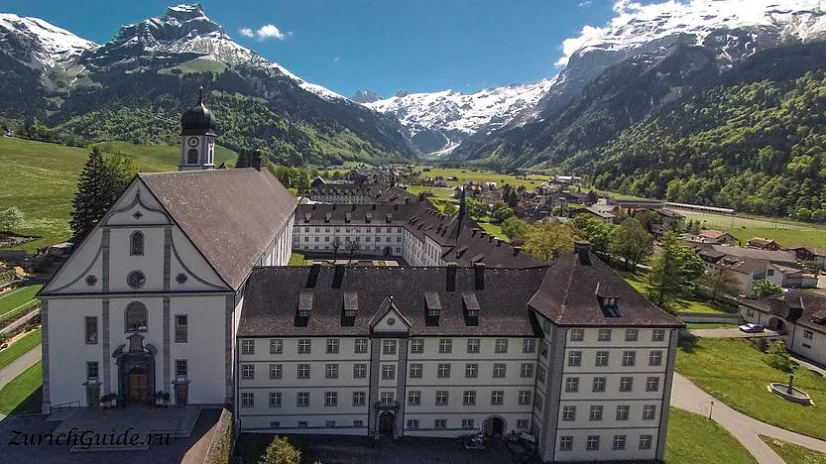
Engelberg Abbey has been continuously occupied by Benedictines since 1120, and the valley was an independent monastic state until 1798 — the abbot was its ruler, and no secular lord had authority here.
The abbey was founded in 1120 by Konrad von Seldenbüren; its first abbot, Adelhelm, came from the monastery of St Blasien in the Black Forest. Pope Callixtus II granted it privileges in 1124, and Holy Roman Emperors added more over the following century — a papal bull of 1236 is said to have put some 150 towns and villages in the surrounding region under the abbey’s authority, with the abbots holding something close to a bishop’s power over them.
That standing weakened during the Reformation, as Zwingli’s teaching spread through central Switzerland and eroded the abbey’s privileges further. Recovery came in the seventeenth century under abbot Benedikt Sigrist, who restored lands and rights the abbey had lost; under his successor, its school and monastic discipline flourished again.
Most of the abbey burned down in 1729, and French revolutionary forces plundered its library in 1798 — it had held, by report, some 20,000 volumes and 200 manuscripts, and among what survived, oddly for a Catholic library, is said to be a complete set of Martin Luther’s works.
The present buildings are eighteenth-century, and the church holds the largest organ in Switzerland. There are guided tours on most weekday afternoons, and the monastery’s own cheese dairy — the Schaukäserei — is open daily and shows the whole process, with a shop at the end.
The dairy shows the whole process through a glass wall, from milk to wheel, and the shop sells the monastery’s own cheese and yoghurt, not found in ordinary shops.
It costs nothing to walk into the courtyard, and the contrast with the cable car queues a kilometre away is the pleasure of the place.
Walking and skiing
In summer the marked paths run in every direction from Trübsee and Fürenalp; the Four Lakes Walk from Trübsee is the popular one, about three hours.
In winter Engelberg is a serious ski area, with the Laub — a famously steep 1,000 m off-piste descent — and a long season on the glacier.
Getting there
- By train — Lucerne to Engelberg in 45 minutes on a rack railway through a tunnel; Zurich in about two hours with the change at Lucerne.
- The whole day from Zurich works comfortably: train to Lucerne, train to Engelberg, cable car up, and back the same evening.
- Passes cover the railway; the cable car is discounted rather than included by a Swiss Travel Pass. See tickets and passes.
- Only route in — Engelberg has no other rail line; every train comes via Lucerne, roughly hourly through the day.
- Tell-Pass — for a stay based mainly around Lake Lucerne, this regional pass covers unlimited travel on public transport and lifts in the area, including Engelberg’s, over a chosen number of consecutive days.
- Rail passes — Eurail and Interrail pass-holders also get a reduced rate on the Titlis cable car.
When to go
June to October for walking, December to April for skiing, and the glacier operates all year.
The rule is the same as everywhere in the high mountains — see the Jungfraujoch — only go up in clear weather, check the summit webcam before buying the ticket, and go in the morning.
Where to park in Engelberg and Titlis
| Car park | Spaces | Fee | From centre |
|---|---|---|---|
| Underground car park | — | paid | 180 m |
| Bahnhof 2 | — | paid | 360 m |
| Bahnhof 1 | — | paid | 460 m |
| Sporting-Park | — | paid | 510 m |
| Titlis P3 | — | paid | 670 m |
| Titlis P2 | — | paid | 760 m |
| Titlis P1 | — | paid | 820 m |
| Titlis P1 Autocars | — | paid | 840 m |
Data © OpenStreetMap contributors, ODbL licence, snapshot of 22 August 2026. The map is drawn by volunteers: the list is not complete, and a dash means “not recorded” — not “free” and not “no spaces”. This is not an official parking directory: when you get there, read the signs and the machine at the entrance.
Weather in Engelberg and Titlis month by month
| Month | Day | Night | Rainfall |
|---|---|---|---|
| January | +1° | -6° | 87 mm |
| February | +2° | -5° | 78 mm |
| March | +6° | -2° | 90 mm |
| April | +11° | +2° | 98 mm |
| May | +15° | +6° | 143 mm |
| June | +18° | +10° | 144 mm |
| July | +20° | +12° | 146 mm |
| August | +20° | +12° | 145 mm |
| September | +17° | +8° | 107 mm |
| October | +13° | +4° | 98 mm |
| November | +6° | -1° | 95 mm |
| December | +2° | -5° | 103 mm |
Averages for 1991–2020, computed from NASA POWER daily data and corrected for the elevation of the place (1016 m). Day and night are the average daily high and low, not records; rainfall is approximate. Current conditions from the Norwegian Meteorological Institute, CC BY 4.0.
Updated: