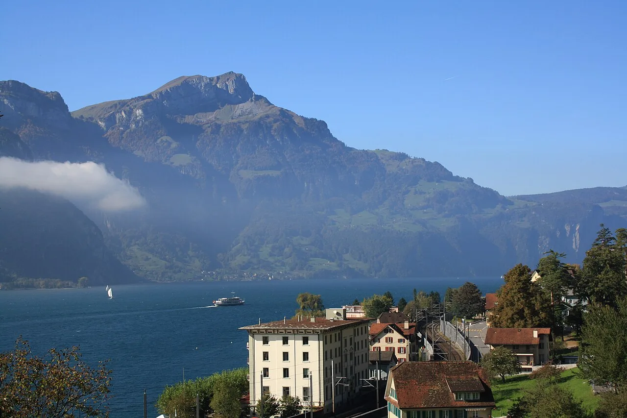

Flüelen
A small port at the far southern end of Lake Lucerne, where the paddle steamers turn round, the Gotthard railway begins its climb, and the story of William Tell is set in the cliffs along the shore.
Flüelen is a small town in the canton of Uri, at the far southern end of Lake Lucerne. It sits on the Urnersee, the narrow, fjord-like arm of the lake that runs south between sheer limestone cliffs, with high mountains closing in on all sides. It is the end of the line for the lake steamers from Lucerne and the place where the Gotthard railway starts its climb towards Ticino.
Until the Axenstrasse was built along the cliffs of the eastern shore in 1865, the only way to get here was by boat, from Lucerne or Brunnen. This is the heartland of the Swiss founding legend: the Rütli meadow, where the first cantons are said to have sworn their alliance, is across the water, and the story of William Tell is set on this shore.
The boat from Lucerne
The best way to arrive is by boat. The trip down the length of Lake Lucerne from Lucerne takes about two and a half to three hours, through the narrows and past villages on the slopes, the Rütli meadow and the cliffs of the Urnersee. In summer some of the boats are paddle steamers from the early 1900s. The boats are public transport, covered by Swiss rail passes.
The boat landing is next to the station, so you can continue by train: north to Lucerne and Zurich, or south over the Gotthard into Ticino. The Gotthard Panorama Express combines the two, a boat from Lucerne to Flüelen and then a panoramic train over the old Gotthard line to Lugano; see panoramic trains.
William Tell
The legend is told like this. Gessler, the Habsburg bailiff of Uri, set his hat on a pole in the square at Altdorf, just south of Flüelen, and ordered everyone who passed to bow to it. Tell, a peasant from Bürglen, walked past with his son and refused. Gessler had him arrested and made him shoot an apple from his son’s head with his crossbow. Tell split the apple, but he had taken a second arrow, and when Gessler asked why, Tell answered that it was meant for him if the first had killed the boy.
Gessler had Tell bound and taken by boat from Flüelen to his castle across the lake. On the way a violent storm blew up, driven by the Föhn, the warm south wind of these valleys, and the boat was about to be smashed against the rocks. Tell was the only man aboard who knew the shore, so they untied him to steer. He brought the boat close to a flat rock, leapt ashore, and pushed the boat back out into the waves. Later he ambushed Gessler in a sunken lane near Küssnacht and shot him dead.
There is no proof that Tell ever lived. But the story, told in its best-known form by Friedrich Schiller in his play of 1804, is at the heart of the Swiss sense of themselves.
What to see
Tellsplatte and Tell’s Chapel
About three kilometres north of Flüelen, on the eastern shore, is the Tellsplatte, the flat rock where Tell is said to have leapt from the boat. Beside it stands the Tellskapelle, a small open chapel rebuilt in 1880, with frescoes of the legend under its arches. Above it are a hotel restaurant among the trees and a viewpoint over the lake.
You can get there by boat (it has its own landing), by car on the Axenstrasse, or on foot along the lakeside paths. Buses do not stop there.
The Schillerstein
The boats from Brunnen also pass the Schillerstein, a natural rock obelisk about 25 metres high standing in the lake near the Rütli meadow. In 1859, for the centenary of his birth, it was inscribed in gold letters to Friedrich Schiller, “the singer of Tell”.
Altdorf
The cantonal capital, Altdorf, two kilometres inland, has the famous Tell Monument of 1895 in its main square, where the apple story is set, and a small Tell museum in nearby Bürglen.
Walking
The Swiss Path (Weg der Schweiz), a waymarked trail around the Urnersee built for the 700th anniversary of the Confederation in 1991, passes through Flüelen. Each canton is responsible for a section in proportion to its population. The stretch north along the eastern shore to Sisikon and Brunnen is the most dramatic, high above the water. See hiking.
Safety on the lake
The Urnersee looks calm, but it is one of the windiest lakes in Switzerland. When the Föhn blows, it can raise steep waves within minutes, which is why the lake is popular with windsurfers and dangerous for everyone else on the water.
- Watch the storm warning lights on the shore. Slowly flashing orange lights mean caution; fast flashing means a storm warning, and anyone on the water, including swimmers, paddleboarders and small boats, should head for the shore at once.
- The water is deep and cold even in summer; swim only near the shore and at the official bathing places.
- The Axenstrasse runs under steep cliffs, and it is sometimes closed after rockfalls. Check the road status before you drive.
Getting there
- By boat from Lucerne, Brunnen and the other lake villages; frequent in summer, fewer boats in winter.
- By train: direct trains from Lucerne and Zurich, or with a change at Arth-Goldau, and regional trains on the Gotthard line towards Erstfeld and Ticino.
- By car: on the Axenstrasse from Brunnen, or on the A2 motorway, which passes through tunnels on the western side of the lake.
For fares and regional passes, see tickets and passes.
Around Flüelen
- Sisikon, a tiny village a few kilometres north on the Axenstrasse.
- Schwyz and Brunnen, at the northern end of the Urnersee.
- Lucerne, at the other end of the lake.
- Bellinzona and Ticino, over the Gotthard.
Nearby
Other places on this site within easy reach, as the crow flies:
- Engelberg and Titlis — 19 km
- Andermatt — 30 km
- Zug — 31 km
- Meiringen and the Reichenbach Falls — 39 km
- Rapperswil — 39 km
- Brienz and Ballenberg — 48 km
This page in Russian: Флюелен (Fluelen)
Weather in Flüelen month by month
| Month | Day | Night | Rainfall |
|---|---|---|---|
| January | +5° | -2° | 70 mm |
| February | +6° | -2° | 59 mm |
| March | +11° | +1° | 72 mm |
| April | +15° | +4° | 81 mm |
| May | +19° | +9° | 117 mm |
| June | +22° | +12° | 138 mm |
| July | +24° | +14° | 141 mm |
| August | +24° | +13° | 154 mm |
| September | +19° | +10° | 105 mm |
| October | +15° | +6° | 84 mm |
| November | +9° | +2° | 81 mm |
| December | +5° | -1° | 83 mm |
Normals for 1991–2020 from MeteoSwiss, station Altdorf, open data, version of 29 July 2026. Day and night are the average daily high and low, not records; rainfall is approximate. Current conditions from the Norwegian Meteorological Institute, CC BY 4.0.
Updated: