Grindelwald
The busiest base in the Jungfrau region, directly beneath the most famous rock wall in the Alps, and the fastest way up to the Jungfraujoch since 2020.
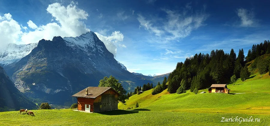
Grindelwald sits at 1,034 m in a broad sunny bowl with the Eiger standing over it — specifically the north face, the 1,800-metre wall that killed climbers through the 1930s while spectators watched from the hotel terraces with telescopes, and which was finally climbed in 1938.
It is the busiest village in the Jungfrau region and the least intimate: a long main street of hotels and sports shops rather than the huddled hamlet of Lauterbrunnen or the car-free shelf of Mürren. What it has instead is space, sun, and the best connections.
Which base to choose
The question everyone asks, so, plainly:
Grindelwald — sunniest, largest, best connected, most crowded. Fastest route to the Jungfraujoch. Choose it if you want convenience and shops.
Lauterbrunnen — in the valley of waterfalls, quieter, and the base for the car-free villages above.
Mürren and Wengen — car-free shelves above Lauterbrunnen, quietest, with the three peaks straight ahead.
All four are within half an hour of each other.
The Eiger Express
Since December 2020 a tri-cable gondola runs from Grindelwald Terminal, beside the station, up to the Eiger Glacier station in fifteen minutes — cutting roughly 45 minutes off the old route to the Jungfraujoch each way.
It has changed the day trip completely: the Jungfraujoch is now comfortably reachable from Zurich and back in a day, and Grindelwald is the side to go up. Guidebooks written before 2020 do not know this.
Grindelwald Terminal also has a large car park, which makes it the practical arrival point if you are driving.
First
The other cable car, going the opposite way, to First at 2,166 m — and the one to do if you are not going to the Jungfraujoch.
At the top: the Cliff Walk, a railed walkway bolted to the rock face ending in a platform over the drop, free with the ticket. Then a set of downhill toys — a mountain cart, a zip line, a scooter run — which sound like a theme park and are genuinely good.
From First, a level path leads in about an hour to Bachalpsee, a lake that reflects the Schreckhorn and Wetterhorn and is on every Swiss calendar ever printed.
The gorges
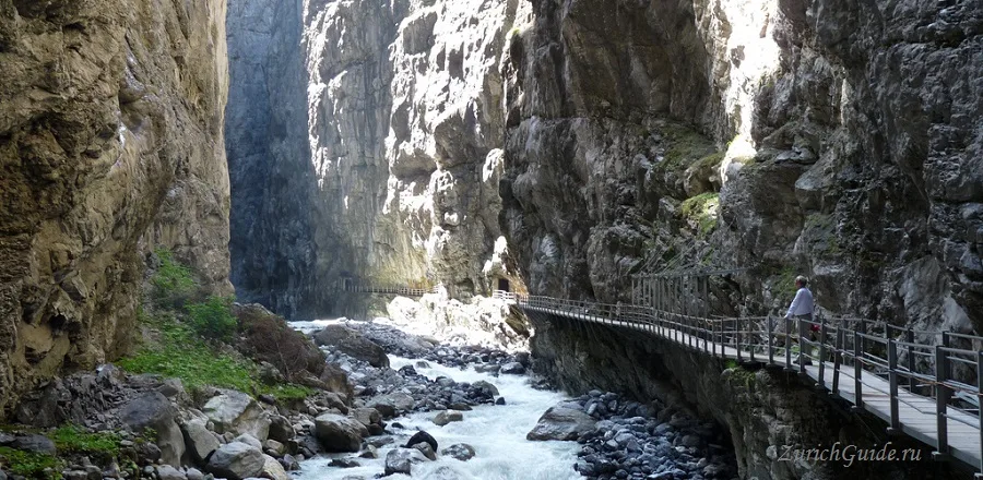
The Gletscherschlucht — glacier gorge — runs from the edge of the village into a slot in the rock where the Lower Grindelwald glacier used to end. Walkways and tunnels lead in, and the marks on the rock show how far the ice reached within living memory.
It is a twenty-minute walk from the village and takes an hour.
Walking
Grindelwald is the best base in the region for walkers because you can climb by lift and descend on foot in several directions:
- First to Bachalpsee — an hour, level, and the classic
- Männlichen to Kleine Scheidegg — an hour and a quarter of almost level path with the Eiger, Mönch and Jungfrau in front of you the whole way. The best effort-to-view ratio in Switzerland.
- The Eiger Trail — from Eigergletscher station along the base of the north face itself, about two and a half hours, and the closest you can get to the wall without a rope.
See hiking for how the path grades work.
Getting there
- By train — Interlaken Ost about 35 minutes; Zurich about two and a half hours with one change.
- By car — as far as Grindelwald Terminal, where the car park is. The village itself is drivable but there is no point.
When to go
June to September for walking; December to April for skiing, with a large linked area shared with Wengen.
The Eiger Express runs all year, and the rule about clear weather applies here more than anywhere: the north face makes its own cloud, and it does it fast.
Where to park in Grindelwald
| Car park | Spaces | Fee | From centre |
|---|---|---|---|
| Parking Eiger+ underground | 160 | paid | 150 m |
| Parkhaus Sportzentrum multi-storey | — | paid | 190 m |
| Auto-Parkplatz | 50 | paidmax 1 d | 470 m |
| Pfingstegg 3 | — | — | 710 m |
| Pfingstegg 1 | — | — | 770 m |
| Pfingstegg 4 | — | — | 770 m |
| Pfingstegg 2 | — | — | 780 m |
| Grindelwald Terminal multi-storey | 1,032 | paid | 1.2 km |
Data © OpenStreetMap contributors, ODbL licence, snapshot of 22 August 2026. The map is drawn by volunteers: the list is not complete, and a dash means “not recorded” — not “free” and not “no spaces”. This is not an official parking directory: when you get there, read the signs and the machine at the entrance.
Weather in Grindelwald month by month
| Month | Day | Night | Rainfall |
|---|---|---|---|
| January | +2° | -7° | 79 mm |
| February | +2° | -7° | 69 mm |
| March | +5° | -3° | 83 mm |
| April | +9° | +2° | 105 mm |
| May | +15° | +7° | 144 mm |
| June | +20° | +11° | 149 mm |
| July | +22° | +12° | 143 mm |
| August | +22° | +12° | 149 mm |
| September | +18° | +9° | 117 mm |
| October | +13° | +5° | 110 mm |
| November | +7° | 0° | 111 mm |
| December | +3° | -5° | 93 mm |
Averages for 1991–2020, computed from NASA POWER daily data and corrected for the elevation of the place (1053 m). Day and night are the average daily high and low, not records; rainfall is approximate. Current conditions from the Norwegian Meteorological Institute, CC BY 4.0.
Updated: