Lauterbrunnen
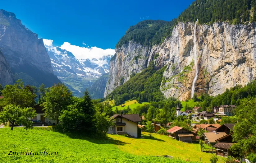
A flat green valley floor between vertical walls 400 metres high, with waterfalls coming off both sides. Tolkien walked it and put it in the books.
Lauterbrunnen is a trench. The valley floor is flat, green and about 400 metres wide; the walls on either side are limestone, near-vertical, and roughly 400 metres high. Water comes off the top of them in seventy-two waterfalls, most of which have no name.
The name means nothing but springs, which is accurate.
J. R. R. Tolkien walked here in 1911 and the valley became Rivendell — the sketch he made on the trip is recognisably this place. It is worth knowing before you arrive, because the first sight of it does feel invented.
The village itself is small and unremarkable, and that is fine: you are here for what is above and around it.
History and the name
Lauterbrunnen, at 802 m, is first recorded in 1240 as in claro fonte — Latin for clear spring — and appears with the German spelling Luterbrunnen by 1268. Brunnen is straightforwardly spring or fountain; lauter is argued over. It can mean clear, pure or bright, which fits the 1240 record, or it can mean louder or more, which is the reading behind the popular “many springs”. Locals tend to prefer the second; the first is closer to the documented origin.
The valley is one of the larger areas of protected landscape in Switzerland. Two things in it are listed as Swiss heritage sites of national significance: the cable car between Stechelberg and the Schilthorn, and the former silver mine at Trachsellauenen, worked from the Middle Ages into the early modern period. The hamlet of Gimmelwald and the Kleine Scheidegg area are on the same national inventory.
The waterfalls
Staubbach
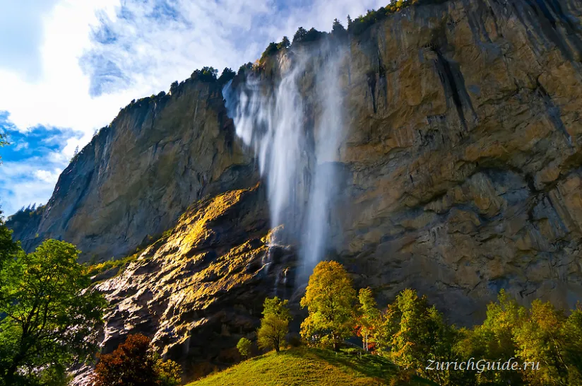
The one you see from the village: 297 metres, falling clear of the rock face in a single drop, and one of the highest free-falling falls in Europe. In a breeze the bottom half turns to drifting mist, which is what Staubbach means — dust stream.
A path climbs to a gallery cut into the rock behind it, ten minutes up from the village and free. You get wet.
Byron and Goethe both wrote about it. Goethe’s Song of the Spirits over the Waters was written after seeing it in 1779.
The gallery path is open only in summer; for the rest of the year it is closed, because of ice and the risk of falling rock. The fall itself appeared on a Swiss postage stamp in the 1930s.
Trümmelbach
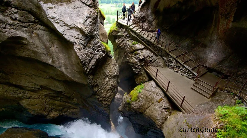
Different, and the more remarkable of the two. The Trümmelbach falls are inside the mountain — ten glacial cascades that have cut a corkscrew through the rock, carrying the meltwater of the Eiger, Mönch and Jungfrau at up to twenty thousand litres a second.
A lift built into the cliff takes you up inside, and galleries and tunnels lead between the falls. It is loud, cold and wet, and it is the only place of its kind open to the public in Europe.
Paid entry, open roughly April to November, about an hour. Bring a jacket.
The ten cascades are cut into the Schwarzmönch, the ridge that divides the Lauterbrunnen and Trümmelbach valleys, and together they drop about 200 metres. The falls are about 3 km down the valley from the village, with their own car park; the postbus from Lauterbrunnen stops right outside.
Above the valley
Nothing on the valley floor takes long. The point is that Lauterbrunnen is the junction for the car-free villages on the shelves above it.
Wengen, on the eastern shelf at 1,274 m, reached by rack railway in fifteen minutes. Car-free, sunny, and the way up towards Kleine Scheidegg and the Jungfraujoch.
The rack railway beyond Wengen was completed in 1912, tunnelling seven kilometres through the Eiger and the Mönch to reach the Jungfraujoch; the station there, at 3,454 m, is the highest in Europe.
Mürren, on the western shelf at 1,638 m, reached by cable car and mountain railway. Smaller, quieter, car-free, and with the better view — the Eiger, Mönch and Jungfrau line up directly opposite.
Above Mürren, the Schilthorn at 2,970 m has a revolving restaurant that was the villain’s lair in On Her Majesty’s Secret Service in 1969 and has traded on it ever since. The view is genuine regardless.
The restaurant is called Piz Gloria. From the deck the panorama takes in around forty peaks and twenty glaciers.
A few kilometres down the valley, reached by a narrow road rather than rail, the hamlet of Isenfluh sits at 1,024 m. Trails from here run down into the valley and on towards Mürren and the Lobhorn peaks, well away from the routes out of Wengen or Mürren itself.
Walking
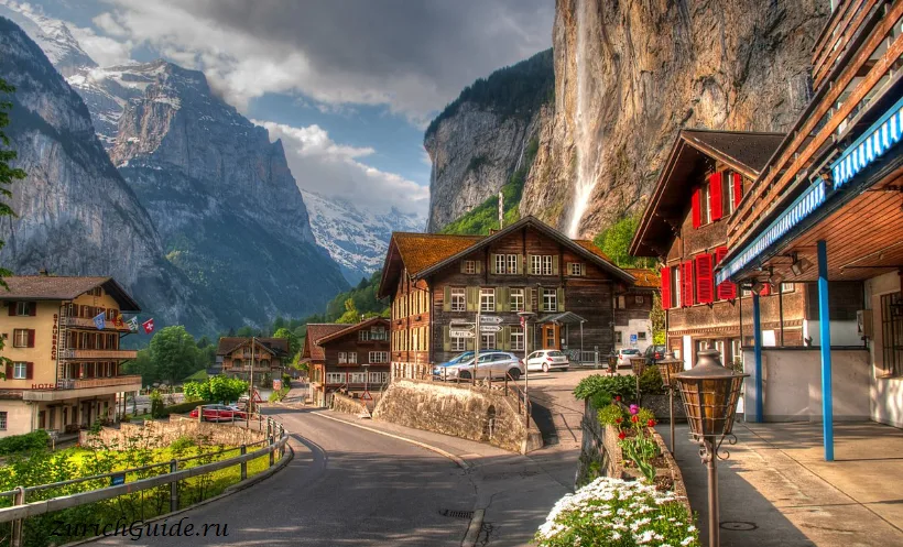
The valley floor walk from Lauterbrunnen to Stechelberg is flat, about 3 km, and passes a dozen waterfalls. Anyone can do it, and the postbus comes back.
Stechelberg is also the lower station for the cable car up to Mürren and the Schilthorn, so the walk down the valley can be paired with a ride back up, or down.
Higher up, the North Face Trail from Mürren is the famous one — a couple of hours on the shelf, looking straight across at the Eiger’s north wall.
A signed trail runs the length of the valley floor as part of the UNESCO Jungfrau-Aletsch-Bietschhorn world heritage region — the first themed trail in that protected area, covering the waterfalls, alpine farming, the valley’s small hydro plants and its mountain hotels.
Getting there
- By train — Zurich about two and three quarter hours via Bern and Interlaken Ost; from Interlaken Ost it is twenty minutes.
- By car — you can drive as far as Lauterbrunnen village and there is a large car park, but Wengen, Mürren and Stechelberg’s upper villages are car-free.
- Base or day trip — the valley works far better as a base than as a day trip. Staying here puts the Jungfrau region’s whole railway network on your doorstep and gets you above the day crowds.
- From Geneva — about three and three-quarter hours by the same route, changing at Bern and Interlaken Ost.
- Regional pass — if you’re moving around the Bernese Oberland for several days, a regional pass covering travel as far as Bern, Thun, Lucerne, Brig and Gstaad, with a discount as far as Montreux, Andermatt and Engelberg, can work out cheaper than single tickets.
When to go
June to September for the walking, with everything open and the falls fed by snowmelt. Late spring is when the waterfalls are at their strongest.
Winter is quiet, and the valley floor gets very little sun — the walls are high enough that parts of it see none at all for weeks around the solstice. Wengen and Mürren above it stay bright, which is precisely why they were built up there.
The region’s ski areas are close by: Wengen–Kleine Scheidegg and Mürren–Schilthorn are both a short ride from Lauterbrunnen by mountain railway, and between them the Jungfrau region has around 45 lifts and 213 km of piste, plus terrain parks, roughly 100 km of winter walking trails and 50 km of toboggan runs. Long cross-country routes also run the length of the valley floor.
Nearby
- Jungfraujoch — the railway up starts from here
- Grindelwald — the other side of the same massif
- Interlaken — twenty minutes, and the junction for everything
- The ten most beautiful towns — Thun is at the far end of the lake
Weather in Lauterbrunnen month by month
| Month | Day | Night | Rainfall |
|---|---|---|---|
| January | +2° | -4° | 72 mm |
| February | +4° | -4° | 67 mm |
| March | +9° | -1° | 73 mm |
| April | +13° | +3° | 82 mm |
| May | +17° | +7° | 122 mm |
| June | +21° | +11° | 127 mm |
| July | +23° | +12° | 146 mm |
| August | +22° | +12° | 146 mm |
| September | +18° | +9° | 94 mm |
| October | +13° | +5° | 80 mm |
| November | +6° | 0° | 80 mm |
| December | +2° | -3° | 91 mm |
Normals for 1991–2020 from MeteoSwiss, station Interlaken, open data, version of 29 July 2026. Adjusted to the elevation of the place. Day and night are the average daily high and low, not records; rainfall is approximate. Current conditions from the Norwegian Meteorological Institute, CC BY 4.0.
Updated: