Schwyz
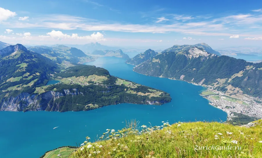
The canton that gave Switzerland its name and flag, with the 1291 charter in a purpose-built archive and the Rütli meadow across the lake.
Schwyz is a small town at the foot of the Mythen peaks near Lake Lucerne, and the country is named after it. So is the flag: the white cross on red was the canton’s banner before it was anyone else’s.
This is the heart of the founding myth, and unusually for founding myths a good deal of it is documented.
The Federal Charter
The Bundesbriefmuseum was built in the 1930s specifically to hold one document: the Federal Charter of 1291, in which the men of Uri, Schwyz and Unterwalden swore mutual aid against anyone who threatened them.
Whether it is the founding document of Switzerland is a question historians argue about — it is one of several such pacts, and the 1291 date was chosen for the anniversary in 1891 rather than the other way round. But it exists, it is here, and it is on parchment in a case in a room built as a shrine to it, with murals of the oath around the walls.
The museum is small and it takes forty minutes.
The town
Schwyz grew rich on the mercenary trade — this canton supplied soldiers to half of Europe for three centuries, and the officers came home with money.
The result is a town of substantial baroque houses in a place with no other obvious reason for wealth. The Ital Reding Hofstatt is the best of them: a 1609 patrician house with painted rooms and a garden, next to a fifteenth-century timber house that is one of the oldest in Switzerland.
The Rütli
Across the lake at Seelisberg lies the Rütli, the meadow where the oath is said to have been sworn. It is owned by the Confederation, it is reachable only by boat or on foot, and there is nothing on it — a field, a flagpole and a view.
That emptiness is the point. It is the national site and it has been deliberately left as a piece of grass.
The Way of Switzerland
The Weg der Schweiz runs 35 km round the Urnersee, the southern arm of Lake Lucerne, from the Rütli to Brunnen. It was laid out for the 700th anniversary in 1991, and each canton was allotted a stretch proportional to its population — five millimetres per inhabitant — in order of joining the Confederation.
It is walked in stages with the boat doing the returns, and it is the most Swiss thing on this website.
Nearby
- Einsiedeln — half an hour, an enormous baroque abbey with a black madonna, and one of the largest pilgrimage sites north of the Alps
- Rigi — the railway from Arth-Goldau, twenty minutes away
- Brunnen and the lake — the boats to Lucerne and Flüelen
- Stoos — a car-free village reached by the steepest funicular in the world, at 110% gradient, opened in 2017
Getting there
- By train — Zurich about 50 minutes to Schwyz, with a change at Arth-Goldau. Lucerne about 45 minutes.
- By boat — from Lucerne to Brunnen, then a short bus.
When to go
Any time; this is a town and a museum. 1 August, the national day, is the obvious date if you want the founding-myth version — there is a ceremony on the Rütli, and bonfires on the mountains all round the lake.
Where to park in Schwyz
| Car park | Spaces | Fee | From centre |
|---|---|---|---|
| Hauptplatz | — | paidmax 1 h | 40 m |
| Kundenparkplatz Raiffeisenbank | — | — | 100 m |
| Parkhaus Hofmatt underground | — | paid | 110 m |
| Mythen Forum underground | 170 | paid | 170 m |
| Parkplatz Brüöl | — | paid | 200 m |
| Parkplatz Steisteg | 15 | freemax 30 min | 200 m |
| Parkhaus Steisteg underground | — | — | 210 m |
| Bahnhofstrasse 7/9 | — | paid | 230 m |
4 more are mapped nearby — see them on OpenStreetMap.
Data © OpenStreetMap contributors, ODbL licence, snapshot of 22 August 2026. The map is drawn by volunteers: the list is not complete, and a dash means “not recorded” — not “free” and not “no spaces”. This is not an official parking directory: when you get there, read the signs and the machine at the entrance.
Weather in Schwyz month by month
| Month | Day | Night | Rainfall |
|---|---|---|---|
| January | +4° | -3° | 70 mm |
| February | +6° | -2° | 59 mm |
| March | +10° | +1° | 72 mm |
| April | +14° | +4° | 81 mm |
| May | +19° | +8° | 117 mm |
| June | +22° | +11° | 138 mm |
| July | +24° | +13° | 141 mm |
| August | +23° | +13° | 154 mm |
| September | +19° | +9° | 105 mm |
| October | +14° | +6° | 84 mm |
| November | +9° | +1° | 81 mm |
| December | +5° | -2° | 83 mm |
Normals for 1991–2020 from MeteoSwiss, station Altdorf, open data, version of 29 July 2026. Adjusted to the elevation of the place. Day and night are the average daily high and low, not records; rainfall is approximate. Current conditions from the Norwegian Meteorological Institute, CC BY 4.0.
Updated: