Zermatt
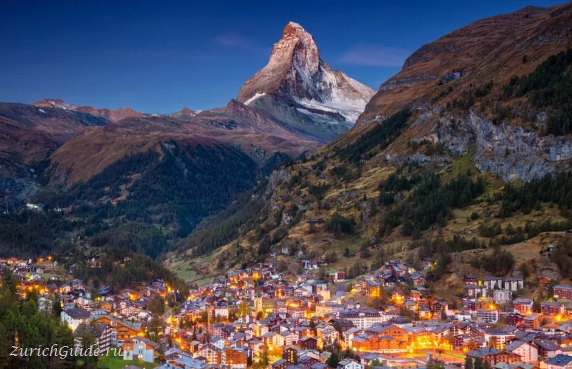
A car-free village at the end of a valley, with the most recognisable mountain in the world at the end of the main street.
Zermatt sits at 1,600 m at the closed end of the Mattertal, and it exists for one reason, which is standing at the end of the main street.
The name is said to come from the local dialect: zer, “towards”, and matta, “meadow” — the place by the meadow at the head of the valley.
The Matterhorn is 4,478 m, it is almost a perfect pyramid, and it is on the Toblerone packet. It was the last great Alpine peak to be climbed — Edward Whymper’s party reached the summit on 14 July 1865, and four of the seven died on the way down when a rope broke. The village has been in the mountaineering business ever since, and the graves of climbers fill a corner of the churchyard.
Zermatt is unashamedly a resort: a village of some 5,800 people that takes two million visitors a year, and where nearly every building is a hotel, a shop or a restaurant. It is also completely car-free, which changes the feel of it more than you would expect.
At the height of the winter season the village can hold something like 20,000 people at once, packed onto the five or six streets that make up the centre.
Arriving
You cannot drive to Zermatt. The road ends at Täsch, 5 km down the valley, where there is a large multi-storey car park and a shuttle train every twenty minutes taking twelve minutes.
By rail: Zurich is about three and a quarter hours with a change at Visp; Geneva about three and a half. From Visp the Matterhorn Gotthard Bahn climbs the valley in an hour, and the ride is worth being awake for.
Inside the village everything runs on small electric vehicles and horse carts. It is walkable end to end in twenty minutes.
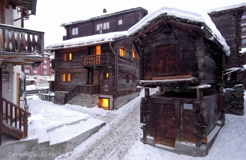
Not every street has a name, so it’s worth finding your hotel on a map before you travel. Guests at the smarter hotels are collected with their luggage by electric cart; everyone else may have some walking to do, though horse carriages and electric taxis are also available if it’s too much. The Gornergrat rack railway station sits directly opposite the main line station, and the high street runs off to the right from there. Without crossing the river behind the station, a walk through the older lanes turns up the traditional timber chalets on stone supports, of the kind in the photograph above.
Zermatt is also the western terminus of the Glacier Express from St. Moritz.
Beyond Brig it is effectively the only direct train out of the valley; travelling anywhere else in Switzerland means changing there.
The mountain railways
The village is a base; the point is going up. Three systems, each with a different view:
Gornergrat
The classic. A rack railway from the village centre climbs to 3,089 m in 33 minutes, and the terrace at the top gives the Matterhorn straight on, with the Gorner glacier below and 29 peaks over 4,000 m around the horizon.
Opened in 1898 and the first electric rack railway in Switzerland. Sit on the right going up.
Dress warmer than you would in the village — it typically runs 10–15°C colder at the summit, though direct sun can make it feel milder than that. There is a café with a terrace and toilets at the top for anyone who would rather not walk down.
Walking down instead takes two to three hours, and the path itself is easy — no scrambling — but it’s a steady, roughly 1,500 m descent, which can tell on the knees if you’re not used to it. The best of the views are in the first couple of stations below the summit; further down the path drops into forest and the scenery closes in. Several intermediate stations let you cut the walk short and take the train the rest of the way.
Climbing Breithorn
The lifts up to Matterhorn Glacier Paradise continue on foot: from the station, descend onto the Theodul glacier and follow the line of the cable car towards Breithorn (4,150 m), said to be the easiest of the Alpine four-thousanders. It’s about two hours to the summit from there, with no strenuous climbing, though a rope is needed for the glacier crossing.
Start as early as the lifts allow — later in the day the snow softens underfoot, and a late finish risks missing the last lift back down to the village.
Rothorn and Sunnegga
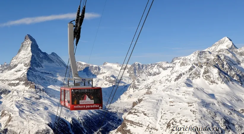
An underground funicular to Sunnegga in three minutes, then gondolas and a cable car on to Blauherd and the Rothorn at 3,103 m.
Sunnegga is where families go — there is a lake, Stellisee, half an hour’s walk from Blauherd, which reflects the Matterhorn on a still morning and is the source of a large share of the photographs you have seen.
Matterhorn Glacier Paradise
The highest cable car station in Europe at 3,883 m, with a glacier palace of ice tunnels inside the rock and, on a clear day, a view that reaches the Mont Blanc massif and into Italy.
It is also where the summer skiing happens — the only place in Switzerland with snow reliable enough to ski in July and August. Since 2023 a continuous cable car link runs across the border to Cervinia in Italy.
Combined with Cervinia’s runs on the Italian side, the linked ski area covers some 360 km of pistes, among the largest in the Alps, and the lifts take in views into Austria and France as well as Italy on a clear day. Mountain restaurants beside the pistes are plentiful throughout the area.
Where to see the Matterhorn
- From the Kirchbrücke in the village — the bridge everyone stops on, and free
- Gornergrat — the postcard, head-on
- Stellisee, above Sunnegga — the reflection, best in the first hour of light
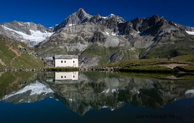
- Schwarzsee at 2,583 m — a small lake and a chapel directly under the north face; the start of the walk to the Hörnli hut, where climbers spend the night before an attempt
- Riffelsee, below Gornergrat — the other reflection, and a twenty-minute walk off the railway
Walking
Above the village is a network of some 400 km of marked paths, and most of them can be started with a lift and finished downhill.
The obvious one is the Five Lakes Walk from Blauherd — about two hours, past five small lakes of which three reflect the mountain. The Gornergrat to Riffelberg descent is another easy hour with the glacier beside you.
The serious version is the Haute Route to Chamonix, which takes a fortnight and proper equipment.
What it costs
Expensive even by Swiss standards, and the mountain railways are the reason: each of the three systems costs a substantial sum for a return trip, and doing all three in a stay adds up faster than the hotel.
Some relief: the Peak Pass covers all the lifts for a number of days, the Swiss Travel Pass discounts the Gornergrat, and the walking is free once you are up. If you are picking one, pick Gornergrat — it gives the most mountain for the money.
A Swiss Transfer Ticket is worth looking at for the trip from Zurich or Geneva airport, since a point-to-point fare to Zermatt is not cheap; staying down the valley in Täsch instead of in Zermatt itself is another way to cut the bill. Don’t expect summer to be any less expensive — Zermatt draws as many hikers as it does skiers, so the high prices run more or less year-round.
When to go
July to September for walking, with everything open and the paths clear. Late December to April for skiing. Late April to June and November are the off-seasons — cheaper, quieter, and with a good share of the lifts shut, so check before booking.
As with the Jungfraujoch, the rule that matters most is weather: the Matterhorn makes its own cloud, and a clear morning is worth reorganising a whole trip around. It is often clear at dawn and covered by noon, so go up early.
Nearby
- Saas-Fee — the next valley, another car-free village under a ring of glaciers
- Täsch — where the car stays
- Brig — the valley junction, with a remarkable seventeenth-century palace
- The panoramic trains — the Glacier Express starts here
Weather in Zermatt month by month
| Month | Day | Night | Rainfall |
|---|---|---|---|
| January | +1° | -7° | 42 mm |
| February | +2° | -7° | 30 mm |
| March | +6° | -4° | 33 mm |
| April | +10° | -1° | 40 mm |
| May | +14° | +3° | 77 mm |
| June | +18° | +7° | 70 mm |
| July | +20° | +9° | 59 mm |
| August | +20° | +9° | 68 mm |
| September | +16° | +5° | 51 mm |
| October | +11° | +2° | 57 mm |
| November | +5° | -3° | 65 mm |
| December | +2° | -6° | 47 mm |
Normals for 1991–2020 from MeteoSwiss, station Zermatt, open data, version of 29 July 2026. Day and night are the average daily high and low, not records; rainfall is approximate. Current conditions from the Norwegian Meteorological Institute, CC BY 4.0.
Updated: